A complex and long-term remediation site in Colorado required assistance visualizing historic and current site data about changes in subsurface conditions over time to present to project stakeholders.
PROJECT GOALS
- Phase 1: Collect, evaluate and manage 50+ years of historic and contemporary data from dozens of sources.
- Phase 2: Prepare 3D and 4D geohydrological models.
TECHNOLOGY USED
In Phase 1 of the project, data was collected from historical site reports, Colorado well permit databases, historical aerial photogrammetry, USGS regional groundwater and LiDAR digital terrain models. The information was evaluated and aggregated into a geodatabase.
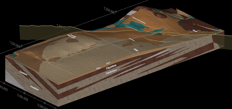
In Phase 2, Cascade used Earth Volumetric Studio (EVS) technology to prepare data-driven 3D and 4D geohydrological models. Information from boring logs was used to uncover the interaction of landfill, overburden and faulted bedrock geology with groundwater plumes over time.
OUTCOMES
Cascade’s 3DVA became a primary planning and decision-making tool, allowing for adaptive site management and supporting future and ongoing site characterization and remedial efforts.